Filed from 42.3601°N 071.0589°W · Boston Local time — · Est. MMXXIV
Vol. 03 — No. 0169 EO ▸ CAPITAL MARKETS Boston · New York · DC · San Francisco

GeoAI, Climate Risk and Tacos.

Earth observation on one side. Capital markets on the other. This is the translation layer — served daily, stripped of hype, and occasionally set on fire.

Fig. 01 Hand-inked illustration: the Earth engulfed in red flames, with a taco in the foreground.
Earth, on fire, with dinner Ink on paper
169 editions filed 4 cities live · 2 building 3–4 stories every weekday 0 press releases reprinted Rated in tacos. Spicy ones get chilis.
§ 01.00What this is

One thesis.
Three ways to get it.


Satellites and sensors can now see almost everything that happens to the physical world. Insurers, banks and asset managers still price most of it badly. Everything here lives in that gap.

Daily
01

The newsletter

Your Daily Taco: a weekday digest of the stories that moved, each with a sober "why it matters." Built for people who have to make decisions, not for people who like press releases.

How it's cooked →
Convened
02

The salons

Tacos: small, curated dinners in the cities where climate risk gets priced. No panels, no pitches, no lanyards. The people who should be in the same room, finally in the same room.

Cities & how to get in →
Long form
03

The writing

Longer-form work on GeoAI, parametric insurance, spatial finance, catastrophe modelling and the regulators leaning on all of it — for audiences that need the real version.

What's on the menu →
§ 02.00'Zines · printed matter

Short, printed, and to the point.


Not a white paper with the personality professionally removed. The photocopied, Sharpie-on-napkins version: case files, manifestos, messy diagrams. One for each city. Handed out at the salon. Free here as PDFs.

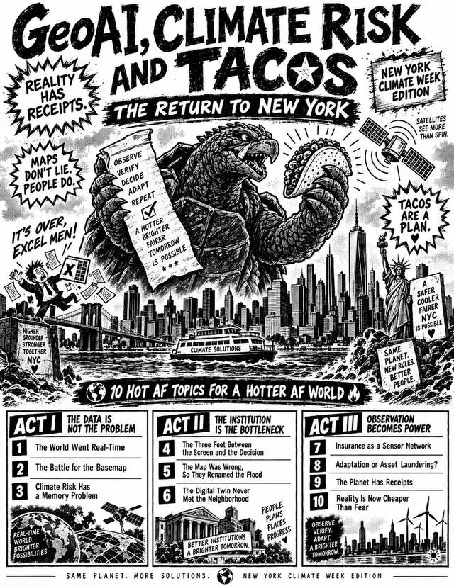
Cover of GeoAI, Climate Risk and Tacos: The Return to New York — New York Climate Week Edition. Hand-inked kaiju holding a taco and a checklist above the Manhattan skyline, satellites overhead and the Statue of Liberty at right. Issue 03 · Climate Week run
New York Climate Week Edition — 2026

Return to New YorkClimate Week ’26

Ten hot AF topics for a hotter AF world, in three acts — the data is not the problem, the institution is the bottleneck, observation becomes power.

20 pages Climate Week run 40.7426°N 073.9902°W PDF · 5.5 MB
Read the PDF →
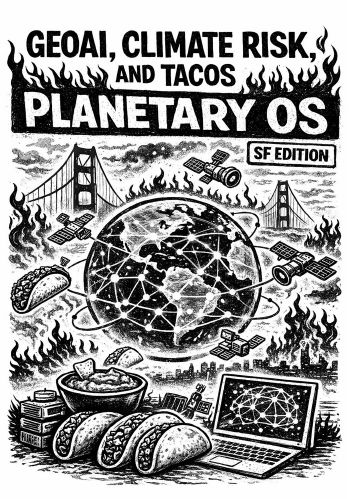
Cover of GeoAI, Climate Risk and Tacos: Planetary OS — SF Edition. Hand-inked flaming globe wrapped in satellite orbits over the Golden Gate, with tacos and a laptop in the foreground. Issue 02 · 200 copies
San Francisco Edition — 2026

Planetary OSSF Edition

Four acts — the builders, the data revolution, the market, the ecosystem — on how Earth observation becomes infrastructure and who gets paid for it.

22 pages Folded & stapled 37.7871°N 122.4002°W PDF · 3.3 MB
Read the PDF →
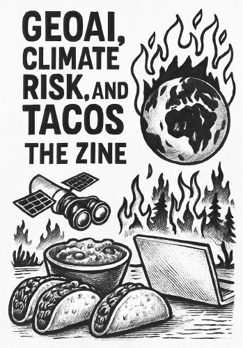
Cover of GeoAI, Climate Risk and Tacos: The Zine — NYC 2025. Hand-inked burning Earth above a satellite with binoculars, a bowl of guacamole, tacos and a laptop. Issue 01 · the original run
New York Edition — 2025

The ZineNYC Edition

The original. Seeing the world through maps and satellites that predict, not just observe — and through the cracks in the systems where bias and inequality hide.

18 pages First printing 40.7572°N 073.9684°W PDF · 3.3 MB
Read the PDF →
§ 03.00Your Daily Taco · every weekday

The news, minus the marketing.


Three or four developments from the previous 24 hours — what happened, where the source is, and exactly why it matters. No recycled press release. No AI slurry. No pretending four decimal places mean certainty.

Standard. The stuff that moved. Read it, act on it.

Spicy. The contrarian pick — coverage that cuts against consensus, names a failure, or exposes an unintended consequence. One per edition, usually.

The four desks
  • GeoAIFoundation models for geospatial, spatial ML infrastructure, EO constellations and open-data releases, benchmarks and tooling.
  • CatCatastrophe, extreme-event and climate modelling — model updates, attribution science, the hazards that matter to a balance sheet.
  • IntelWho shipped, who raised, who partnered in climate-AI insurtech, and what the regulators just did to them.
  • ContraThe dissent desk. Only the credible against-the-grain reads. If it's what everyone already believes, restated, it doesn't run.
Intelligence Dispatch No. 0169
Filed 15 Sep 2026 Desks: GeoAI · Cat · Contra Read this edition →

Presentado No Es Comparable

Early climate-risk disclosures show widespread reporting gaps — challenging the assumption that mandatory reporting quickly produces comparable, decision-ready information.

Why it matters Reporting volume grows faster than data lineage, internal controls and board challenge. Discount apparently comparable climate metrics until assurance and scope coverage have been checked. Filed is not the same as usable.

Source: Environmental Protection Online

Volver a Entrar, Casa por Casa

DUAL, Kingstone and Windward Risk Managers are using ZestyAI's Z-FIRE to support new California homeowners programs — after January 2025's LA fires destroyed 16,200+ structures and an estimated $40bn in insured losses.

Why it matters We have covered the retreat all month. This is the return, and it arrives through a different door: not broad appetite, but property-level selection.

Source: Insurance Edge

El Mismo Píxel, Otro Propósito

US officials are reported to have linked Chinese satellite imagery to an Iranian strike that killed three troops. The provider, the data type and the attribution chain are all unidentified — and the rating reflects it.

Why it matters Screening is designed around the customer's identity, not the imagery's eventual use. Those are different questions, and only one of them has ever been answered.

Source: The Wall Street Journal
Clipped · 24h
Cite the source
§ 04.00Best of the Week · weekly

Five days of tacos,
one plate.

Don't have time for the daily? Once a week, the stories that actually mattered — re-rated with hindsight, with the spicy pick of the week called out.

Latest plate · week ending 4 September 2026
Nobody knows which model is best.
Best GeoAI

A 152-paper audit concludes the geospatial foundation-model literature cannot support any claim about which model wins.

Best Climate Risk

A 32× increase in issuer climate risk added just 4.2 basis points to municipal bond yields.

Best Contrarian

AI load growth turned the most stranded assets in the US into reliability-critical ones.

§ 05.00Podcast · in production

Same table,
with microphones.

The salon conversations that shouldn't stay at the table — reinsurers, remote-sensing scientists, bank risk officers and founders on how the physical world actually gets priced.

  • FormatOne guest, one hard question, no press-release answers.
  • BeatsGeoAI, Earth observation, cat modelling, parametric insurance, spatial finance.
  • NotifySubscribe to Your Daily Taco — the first episode drops there.

No panels.
No pitches.
No PR voice.

§ 06.00 — Tacos, the salons 12 covers · placed on purpose Dinner, not a conference
§ 06.10The table

The seating chart is the analysis.


A dozen people. One table. One city where climate risk actually gets priced. Reinsurers beside remote-sensing scientists. Bank-risk officers opposite the founders building what they will need eighteen months from now.

Salon seating plan, drawn as a survey diagram A plan view of one round table with six labelled seats — reinsurer, remote-sensing scientist, bank-risk officer, founder, regulator, infrastructure operator — with sight-lines drawn between the pairs that do not normally meet. ONE TABLE 12 COVERS · PLACED ON PURPOSE 123 456 REINSURER REMOTE SENSING BANK RISK FOUNDER REGULATOR INFRASTRUCTURE THESE TWO NEVER MEET ITEM 07 — PITCH DECK v7 STATUS: DECLINED AT THE DOOR
Plan view · not to scale Sheet 06 of 08
  1. Curated, not open

    Every seat is placed on purpose. The mix is the product — no seat is filled to fill it.

  2. No panels. No pitches.

    Nobody presents. Nobody demos. If you want a stage, there are a thousand conferences for that.

  3. Real conversation

    What people say at the table stays at the table. That's what makes it worth showing up for.

  4. Hosting over attending

    The whole network runs on people who host a node in their city rather than fly to someone else's.

Node register · § 06.20
CityCoordinatesStatus
Boston42.3601°N 071.0589°WLive
New York40.7128°N 074.0060°WLive
Washington, DC38.9072°N 077.0369°WLive
San Francisco37.7749°N 122.4194°WLive
Providence41.8240°N 071.4128°WBuilding
Baltimore39.2904°N 076.6122°WBuilding

Best way in: a note on LinkedIn saying which city, what you do, and who you'd want across the table.

§ 07.00The writing · long form

What's on the menu.


Longer-form pieces for banking, insurance and supervisory audiences — the ones that have to sign off on a model, not admire it.

File 01 — GeoAIGround truth

GeoAI & Earth observation

Geospatial foundation models, what they can and cannot see, and how their outputs become — or fail to become — decision-grade inputs.

File 02 — ParametricBasis risk

Parametric insurance

Trigger design, basis risk, and why the index is the product. Where parametric works, where it's marketing, and how to tell.

File 03 — Spatial finance40.71N 74.01W

Spatial finance

Geospatial data as alternative data across capital markets, credit, underwriting and supervision. The translation layer, written out.

File 04 — CatRP 1-in-100 · rev.

Catastrophe & climate modelling

Wildfire, flood and wind models under a changing climate; what the vendors' updates actually change; where attribution science meets the loss side.

Vendor "update" ≠ new science
File 05 — SupervisionShow your sources

Regulation & supervision

Bank of England, NGFS, EU CSRD and the US patchwork — read for what they force institutions to measure, not what they say they hope for.

File 06Time-stamped

Forensic observability

Using the satellite record as evidence: what happened, when, to which asset — and how that becomes something a claims desk or a court can rely on.

GeoAI is how financial institutions finally price the physical world.
— the line the whole site is built on
§ 08.00’Bout

Hi, I'm Tee.

I have spent more than twenty years in geospatial technology across defence, disaster response, climate and insurance. I work in the gap between what Earth observation can prove and what financial institutions are prepared to price.

Then I convene the dinners where the people on either side of that gap finally meet.

Based in Boston · regularly in New York, DC and San Francisco
Record of current work
  • FounderClimate & Geospatial Intelligence Group (C&GIG)
  • Co-FounderGeospatial Risk — a geospatial events company
  • AdvisorStart-ups in GeoAI, Earth observation and climate risk
  • FacultyNortheastern University
  • CouncilorAmerican Geographical Society
  • EditorWriter of Your Daily Taco; convener of the Tacos salons